MagZone
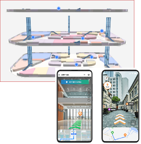
A comprehensive map engine customized for clients, it provides powerful 3D spatial data visualization and navigation functions, allowing users to easily build spatial information management, building information management, and other applications, achieving intuitive display and management of complex spatial data.
Product Introduction
Multi-technology Positioning Integration Interface
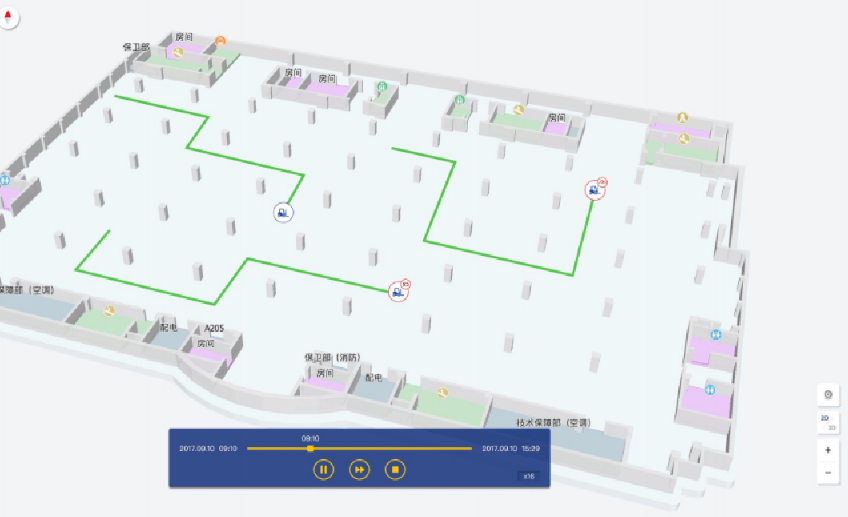
Select common positioning technologies based on actual scenarios to standardly display personnel/equipment positioning and movement trajectories.
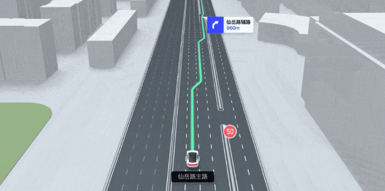
Pathfinding
Can draw multi-dimensional and multi-layer maps to help users quickly find their destination.
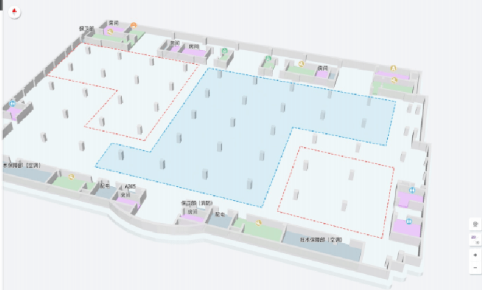
Map Fencing
For setting up areas, custom function development can be done for people within the range, such as pushing information.
Augmented Reality
Integrates AR effects to enhance location interaction and navigation experience.
Dwell Time
Estimates user dwell time to analyze user behavior.

MagZone - Multi-technology Positioning Integration
Comprehensive positioning technology solution: integrates multiple positioning technologies, can automatically calculate positioning results seamlessly switching from indoor to outdoor based on users' actual on-site conditions.
| MagZone | Geomagnetic Positioning | Bluetooth Positioning | WiFi Positioning | GPS Positioning | GPS Positioning | |
|---|---|---|---|---|---|---|
| Scenario | Indoor/Outdoor | Indoor | Indoor | Indoor | Outdoor | Outdoor |
| Environment | All Environments | Can be Offline, Requires Power | Requires Network and Power | Requires Network and Power | Requires 4G Signal and Power | Requires Network and Power |
| Deployment Installation | Can be Installation-Free/Supports Base Stations | Installation-Free | Requires Installation | Requires Installation | Installation-Free | Requires Installation |
| Accuracy | Less than or Equal to 1m | 1m | 5 to 10m | Greater than 10m | Greater than 10m | Less than or Equal to 1m |
| Stability | Not Affected by Obstructions and Interference | Not Affected by Obstructions and Interference | Affected by Obstructions and Interference | Affected by Obstructions and Interference | Easily Affected by Signal Interference | Affected by Obstructions and Interference |
Conclusion: MagZone, due to its integration of multiple positioning technologies, can adapt to all environments. Based on actual environmental conditions and accuracy requirements, it selects the appropriate positioning solution.

Pathfinding
- AR pathfinding is simple and fun to use. Enhance user AR experience through POI and location-aware AR content (such as ads or social media posts embedded in the real world).
- POI helps your customers easily find their way to their destination. Enable navigation from point A to point B and add metadata to the map.

Positioning Monitoring
- Based on geomagnetic positioning systems, real-time viewing and monitoring of personnel distribution, number of people in each area, tracking of key objects, system alarm events, and processing status can be done on a 3D map.
- By associating with monitoring big screens, comprehensive display of key data, automatic statistics, storage, alarm, and no need for real-time monitoring by management personnel can enhance the automation, informatization, and intelligence level of safety management.

Map Range and Area Management
- Easily set key areas by drawing points and lines on the map, and match them with each person's permissions to achieve area management and electronic fencing functions.
- Can be set based on conditions such as the density of people in the area, and real-time monitoring and alarm.
- Can quickly jump to the designated area to view the working status of personnel in that area at this time.

Trajectory Tracing
- Visualize personnel movement trajectories and historical trajectories, and can review records of personnel entering and exiting work areas at any time to provide a basis for employee performance evaluation or job assignment.
- Optimize business processes through statistical analysis of personnel work routes.
Application Scenarios
Medical Industry
Emergency backup power systems for hospitals ensure rapid switching in case of main power failure, guaranteeing continuous operation of critical medical equipment and life support systems.
Railway, Aviation
Used for backup power monitoring of railway signaling systems and station batteries; controls battery status in airport and air traffic control systems.
Telecommunications Industry
Monitors the battery status of telecom base stations, ensuring uninterrupted power supply for communication networks, and guaranteeing the stability and reliability of communication services.
Banking
Monitors the battery status of bank data centers and ATMs, ensuring the continuity of financial transactions and data security.
Power Industry
Monitors the battery systems of power plants and substations, ensuring the stability and emergency response capability of power supply.